
Page
Out
Records
Kerry
Links
|
||||
| |
||||
| Home Page |
Starting Out |
Online Records |
Research Kerry |
Resource Links |
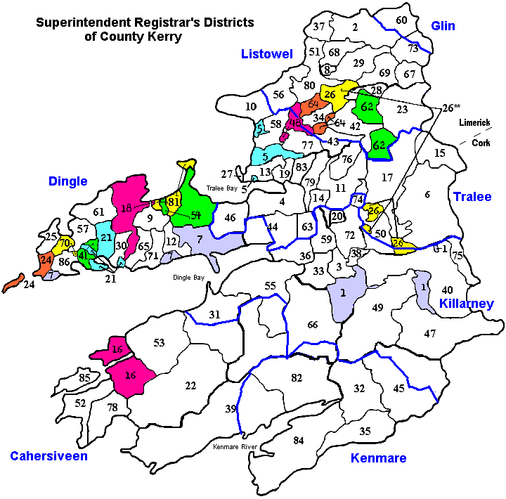
Below is a map showing approximations of DED Registration Districts of County
Kerry including numbered Civil Parishes. Below the map is a list of
all the corresponding Civil Parish names. Click on a Parish name from the
list to go to a Townland map of that Parish.
Thanks to John
Willoughby for providing the information needed in creating this map
for you.
| ** There are two seperate parishes named Dysert * Alternative Spellings (by no means complete) |
|
| Ballyheige = Ballyheigh Caher = Cahir Castleisland = Castle Island Glanbehy = Glanbeigh, Glenbay |
Kilcaskan = Kilcuskan Knocknane = Knockane Kilmalkedar = Kilmelkadar, Kilmalchedar Valencia = Valentia |