Tartaraghan Civil Parish
County Armagh, Northern Ireland
| Civil Parish | Tartaraghan | Tartaraghan | Tartaraghan |
| Barony | Oneilland East | Oneilland West | Oneilland West |
| Poor Law Union | Armagh | Armagh | Lurgan |
| Catholic Diocese | Armagh | Armagh | Armagh |
| Catholic Parish | Loughgall | Loughgall | Loughgall |
|
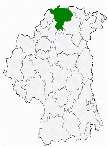
TARTARAGHAN, or the LOW PARISH, a parish in the barony of Oneilland West, county of Armagh, and province of Ulster, 3 miles (N.E.) from Loughgall, on the road from Lurgan, by Verner's-Bridge, to Dungannon; containing 6321 inhabitants. This parish is bounded for a short distance on the north-east by the river Bann, and on the north-west by the river Blackwater; it formerly was part of the parish of Drumcree, from which it was separated by act of parliament in the 8th of Queen Anne, and erected into a distinct parish, comprising, according to the Ordnance survey, 11,612 statute acres, of which 2122¾ are in Lough Neagh, and in small lakes. The lands are chiefly under tillage; the soil is light, but fertile; and the system of agriculture is progressively improving. In the lower extremity of the parish, bordering on Lough Neagh, is a large tract of valuable bog; and there is a quarry of whinstone, which is raised chiefly for building. The principal seats are Crow Hill, the residence of J. Atkinson, Esq.; and Clantileu, of E. Obrie, Esq. About one-sixth of the population are employed in the linen manufacture. A manorial court is held at Clantileu, every third Thursday, for the recovery of debts to the amount of 40s.
The living is
a rectory, in the diocese of Armagh in the successive patronage of the
Lord-Primate, the Earl of Charlemont, and Chas. Brownlow, Esq.; the tithes
amount to £276. 18. 6. The glebe-house was erected in 1775, at an
expense of £523, of which £100 was a gift from the late Board of First
Fruits, and the remainder was defrayed by the incumbent; the glebe
comprises 40 statute acres, valued at £50 per annum. The church,
originally built in 1712, on land given by Francis Obrie, Exq., who also
endowed it with the tithes of eight townlands and gave 40 acres of land
for a glebe, is now in ruins; the present church was built in 1916, for
which purpose the late Board of First Fruits granted a loan of £800.
Divine service is also preformed every Sunday in summer, and on alternate
Sundays in winter, in a building formerly used as a place of worship for
Wesleyan Methodists. The R.C. parish is co-extensive with that of
the Established Church; the chapel, a very neat edifice, is at Eglish.
There is a place of worship for Presbyterians of the Seceding Synod, of
the second class, and also for Wesleyan Methodists. About 260
children are taught in five public schools, of which two are supported by
the rector and Mr. Obrie, and one by Col. Verner; and there are four
private schools, in which are about 160 children, and four Sunday schools.
Adjoining the village of Moghery, and close on the shore of Lough Neagh,
are the ruins of the old church; and in the townland of Eglish is an
ancient cemetery, still used as a place of sepulture. In the
townland of Derrycorr is a curious ancient road, formed of large oak trees
placed longitudinally with planks of cleft oak laid over them
transversely, and covered with sand and gravel about a foot deep, forming
a road across the bog at a considerable depth below the surface, and in an
excellent state of preservation, though, from the accumulation of
superincumbent bog, the timber must have remained there for many
centuries. The sand and gravel were evidently brought from Lough
Neagh, from portions of petrified wood and chalcedony being intermixed
with them; and the road, which was recently discovered while cutting turf,
is traceable for nearly two miles to the Lough, and is supposed by the
peasantry to have been constructed by St. Patrick, for the purpose of
conveying sand for the building of Armagh cathedral. In the year
1815 a golden gorget, weighing 12 oz. and richly chased, was found in one
of these bogs, and was purchased by the Rev. F. Gervais, rector of the
parish. |
|
Do you have a description of this civil parish or a picture? If you send it/them, I will put it/them in this space. |
Townlands
LDS Film Numbers
| Film Title | Film number(s) |
| Tithe Applotments, 1834 | #258469 |
| Ireland Census, 1901 | #808507, #812101 |
| Ireland Census, 1911 | #1999864, 1999865, 1999916, 1999587-9 |
|
(before ordering films, check # for accuracy) |
| SURNAME | CONTACT |
| Campbell | Pat Connors |
| Miller, Millar | Georgia Geske |
| Todd | Pat Connors |
| To add your surname | Email IGP County Armagh |
|
Civil Parish Links |
| Tartaraghan Civil Parish Griffith's Valuation Index, John Haye's website |
| Add your links, send an email describing link and don't forget the URL |
|
This page is under construction! |
|
|
|
Information to be added:
|
|
Your help is needed. If you have anything that you think will add to this website, including records, that will help others when researching this civil parish's genealogy, please email me. |

Back to the County Armagh Land Divisions website....
Back to the County Armagh website....

©2001-2006ConnorsGenealogy,
Ireland Genealogy Projects
last updated
December 16, 2006