 Mosley's
Lane was located some where on the North side of Tullow Street.
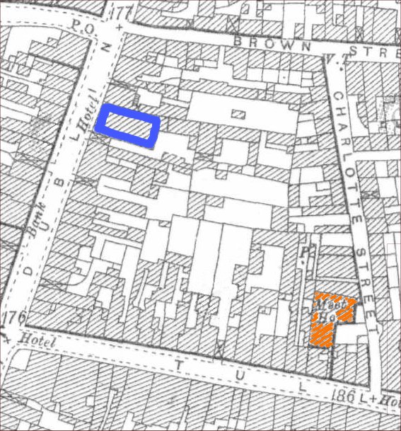
According to a presentation on "Quakers in Co. Carlow". By John Smyth he
mentions that a meeting house (in red on the map) was built in 1712 on
the North side of Tullow St. at the junction with
Mosley’s Lane
and the land for it was leased in 1716 “for ever”. Mosley's
Lane was located some where on the North side of Tullow Street.
According to a presentation on "Quakers in Co. Carlow". By John Smyth he
mentions that a meeting house (in red on the map) was built in 1712 on
the North side of Tullow St. at the junction with
Mosley’s Lane
and the land for it was leased in 1716 “for ever”.
Source:
http://www.ballonvillage.com/wp-content/uploads/2010/12/Quakers-Talk.pdf
 The
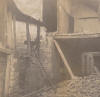
following was written by Michael Purcell "The Carlow historian Michael
Brophy believed that Mosley's Castle was situated in Mosley's Lane
and that portion of the Wall of Carlow was in this area ~ this picture
dated 1897 is from his papers ~ recorded on the rear of picture in
Michael's handwriting is the following note "on the left hand side is what
remained of the ruins of Mosley's Castle, the main building was demolished
in 1840 to build sheds for James Morris". ~ A big house was often referred
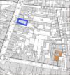
to as "a castle". The lane ran from Tullow Street to Dublin Street, ~ in
recent times exiting adjoining the Royal Hotel car park (in blue on the
map) and number 9 Dublin Street. The
following was written by Michael Purcell "The Carlow historian Michael
Brophy believed that Mosley's Castle was situated in Mosley's Lane
and that portion of the Wall of Carlow was in this area ~ this picture
dated 1897 is from his papers ~ recorded on the rear of picture in
Michael's handwriting is the following note "on the left hand side is what
remained of the ruins of Mosley's Castle, the main building was demolished
in 1840 to build sheds for James Morris". ~ A big house was often referred
to as "a castle". The lane ran from Tullow Street to Dublin Street, ~ in
recent times exiting adjoining the Royal Hotel car park (in blue on the
map) and number 9 Dublin Street.
|